An international team of Romanian researchers has conducted one of the most ambitious aerial scientific missions to date, right in the heart of Buzău’s Muddy Volcanoes.
The team’s objective was two-fold: to become familiar with a cutting-edge scientific method, and to decipher the hidden structure of this unstable terrain and better understand the geological risks that can affect both the environment and surrounding communities.
How a Flying Geophysical Lab Works
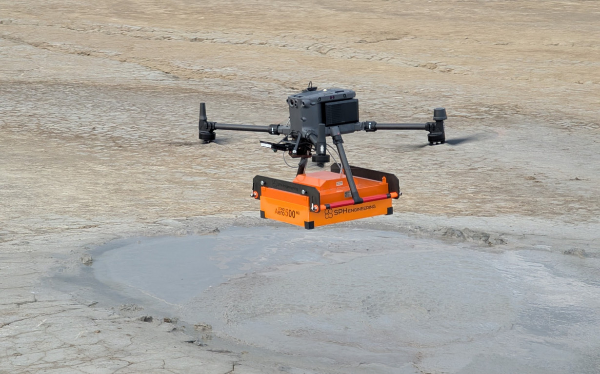
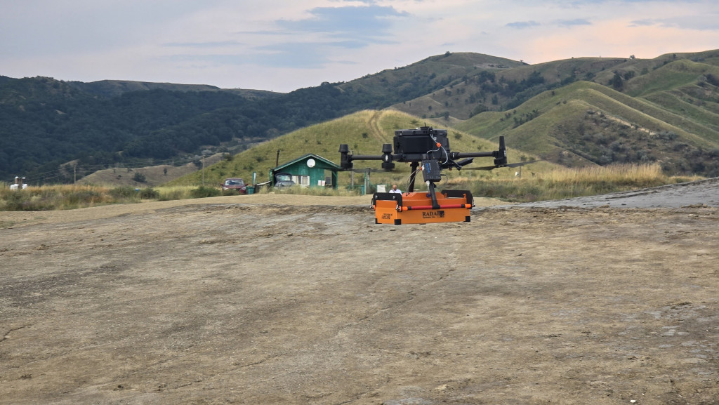
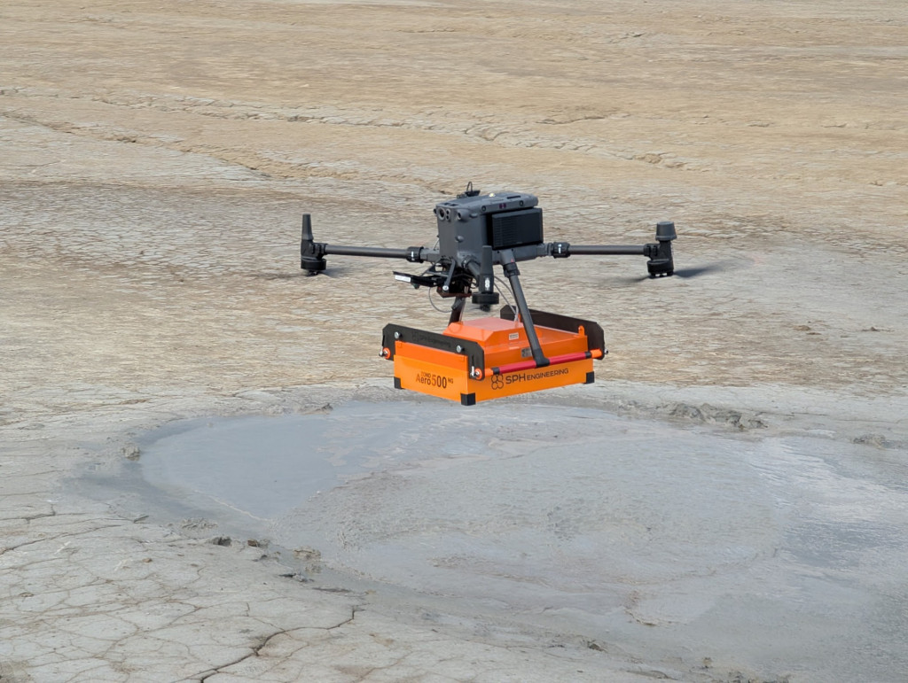
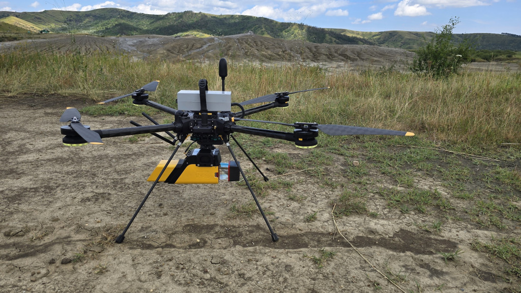
Researchers from the National Institute for Earth Physics (INFP), in collaboration with specialists from Skyline Drones and the Latvian company SPH Engineering, launched drones equipped with an impressive range of sensors.
- LiDAR precisely mapped the terrain with millimeter accuracy.
- GPR (Ground Penetrating Radar) sent waves underground to detect cavities and subterranean flows.
- Magnetometers measured subtle anomalies in the magnetic field.
- Gas sensors analyzed the methane emitted from the volcanoes.
- The team also conducted thermal monitoring of the surface.
“The equipment is state-of-the-art, but we’re not just using it to tick a box on a campaign. The goal is to understand how the method works in detail so we can apply the same methods to both the Muddy Volcanoes and other areas with geological risks,” says Alexandra Gerea, an INFP researcher.
This isn’t the first time the INFP team has visited the Muddy Volcanoes. In previous years, the same researchers conducted geoelectric campaigns here using cutting-edge equipment, which allowed them to identify subterranean structures and gain insight into fluid migration areas. This data has now been complemented by aerial drone monitoring, turning the site into a true testing ground for integrating multiple modern geophysical exploration methods.
“We are in an exploratory phase: we are testing geophysical and remote sensing methods to find the combination that best captures the complexity of these volcanoes,” says Gerea. “Two years ago, we used the FullWaver geoelectric system for the first time in Romania, which allowed us to create 3D resistivity images of the subsoil. We identified areas of intense activity—ascending columns of fluids with a rich chemical content.”
GeoEduLab: Science, Prevention, and Education
The mission at the Muddy Volcanoes was part of GeoEduLab, a laboratory within the INCDFP designed to bring geophysical research closer to the real needs of society.
In addition to aerial technology, the team also uses classic geophysical instruments—from seismic and magnetometric equipment to GNSS stations and microgravity meters. This allows the drone data to be correlated with detailed ground observations, providing a more complete picture of subterranean processes. This combination of methods allows GeoEduLab to function as an integrated lab where field research, risk prevention, and scientific education are intertwined.
The lab isn’t just about technology; it’s also about training. Researchers learn to operate drones and interpret multisensory data, which is then fed into integrated databases on geological risks with direct applications in disaster prevention.
“The mission contributes to expanding the institute’s research portfolio by integrating advanced UAV (Unmanned Aerial Vehicle) technologies. It’s not at all easy; these methods pose operational challenges and require rigorous application, but they offer huge potential to bring new and valuable data to current scientific activities,” says Mihai Andrei.
The campaign was also a comparative exercise: the aerial radar data will be placed alongside the ground data to validate the accuracy of the sensors and make comparisons. Even from the preliminary results, there are interesting findings.
“We are testing and combining geophysical and remote sensing methods to capture the complexity of the muddy volcanoes,” says Andrei. “In this campaign, we tested the GPR method, which we believe is a first for these volcanoes. We are evaluating the quality of the subsoil image both on the dry mud surface and from the air with drones. We are still in the analysis phase, but if we show that airborne GPR provides sufficient quality, the gain will be huge: much faster, safer acquisition and coverage in areas inaccessible to ground teams.”
Drones, More and More Important in Research
Drones are changing the way we explore the Earth. Instead of heavy equipment and invasive drilling, they offer fast and safe access to hard-to-reach areas. Costs decrease, speed increases, and researchers can layer multiple types of measurements in a single campaign.
This versatility is essential at the Muddy Volcanoes, where the terrain is unstable and filled with craters and mud channels that are difficult to navigate with geophysical equipment. Where people cannot safely walk, drones become the eyes and instruments of science. They can fly just a few meters from the ground, faithfully following the irregular terrain, and can simultaneously collect topographic, magnetic, and chemical data.
Additionally, the technology allows for repeated measurements along the same flight paths at regular intervals to observe geomorphological changes in real-time. In a dynamic environment where gases constantly escape and mud reconfigures the terrain from day to day, this ability for continuous monitoring is crucial.
The Muddy Volcanoes area, though famous for tourism, is surprisingly under-documented geophysically. This campaign is a necessary step toward mapping the subterranean gas migration pipelines and identifying areas with the potential for landslides or subsidence.
“The area is poorly documented geophysically, despite its tourist and scientific potential,” says Mihai.
Researchers say the value of drones isn’t limited to this site. The technologies tested here can be transferred to other regions with similar risks—from landslides in the Carpathians to seismic zones in Vrancea or gas fields in Dobrogea. Thus, the Muddy Volcanoes are not just a local study site but a starting point for a methodology applicable on a national scale.
The UNESCO Connection
The research is also part of a partnership with the Ținutul Buzăului UNESCO International Geopark. The stakes are twofold: increasing scientific knowledge and supporting the geopark’s UNESCO status revalidation, a process scheduled for 2025.
In the long term, INCDFP and GeoEduLab plan to install permanent seismic and GNSS monitoring stations at Pâclele Mici to observe subtle ground movements and seismic activity in the area. The data could be displayed publicly in real-time, transforming the area into not only a protected site but also an educational center for visitors.
“It is a complex and dynamic area, an important area for Romania that deserves more exploration,” says Gerea. “That’s why we return to the field: to better understand this living system in continuous change.”
Comunicatele și materialele publicate pe această pagină pot fi preluate integral sau parțial, cu condiția menționării explicite a sursei și includerii unui link activ către această pagina.